
2023 is the Year of the Trail in North Carolina, and we're celebrating by showcasing a different Featured Hike each week. If you'd like to hike with us on one of the Featured Hikes, head to our Trips Calendar and book a private hike!
Mt Sterling Loop (Great Smoky Mountains National Park)
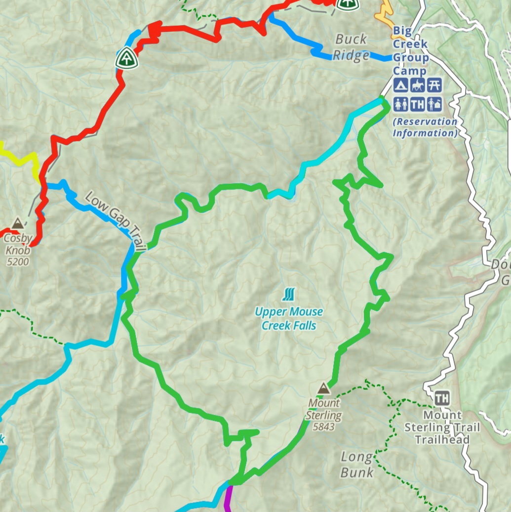 Primary Trailhead: Big Creek Trailhead in Great Smoky Mountains National Park
Mt Sterling is a Guide Favorite every year, especially among our ultra runner and long distance hiker guides. Standing just under 6,000ft with a historic fire tower on top, Mt Sterling has beautiful views both to the east and west. This loop is a monster day hike at 18 miles, or a fantastic multi-day trip. Starting from the Big Creek parking lot, start on the Big Creek Trail and pass Midnight Hole Falls and Mouse Creek Falls. Hike up Swallow Fork Trail to the Benton MacKaye Trail (Mt Sterling Ridge Trail), and hike northbound toward Mt Sterling. The firetower is near the summit at the junction with Baxter Creek Trail. Take Baxter Creek Trail back downhill to Big Creek Trailhead to complete the loop. Baxter Creek Trail has an incredible diversity of wildflowers in the springtime! Swallow Fork Trail has several un-bridged creek crossings, so hikers should be prepared to get their feet wet.
We offer this as a guided hike! This is a great 3-day novice Backpacking Trip.
Moore Cove Falls
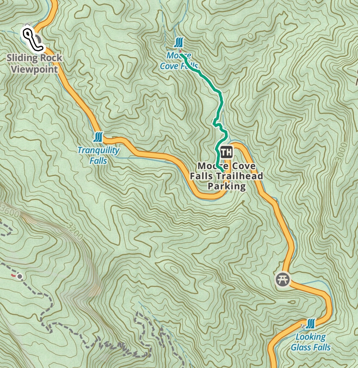 Primary Trailhead: Moore Cove Falls Trailhead in Pisgah National Forest
In the heart of Pisgah National Forest’s “Land of the Waterfalls”, this 1.2-mile out and back hike is great for the whole family. Moore Cove Falls is a low-flow waterfall accessed by a .6 mile, well-graded trail. Hikers can walk all around the waterfall and even underneath it! Try standing close by and gazing up as the droplets fall toward you. You’re bound to be mesmerized into another world! While you're in the area, check out nearby Looking Glass Falls and Cedar Rock Falls. Be warned! This area gets very crowded on weekends, especially in the summertime when hikers want to cool off by the water. Be sure to stop by Dolly's for some ice cream or the Pennycup Coffee Truck for delicious iced latte on your way home.
We offer this as a guided hike! This is a great portion of a Half or Full Day Waterfall Hike.
Rattlesnake Lodge (Asheville, NC)
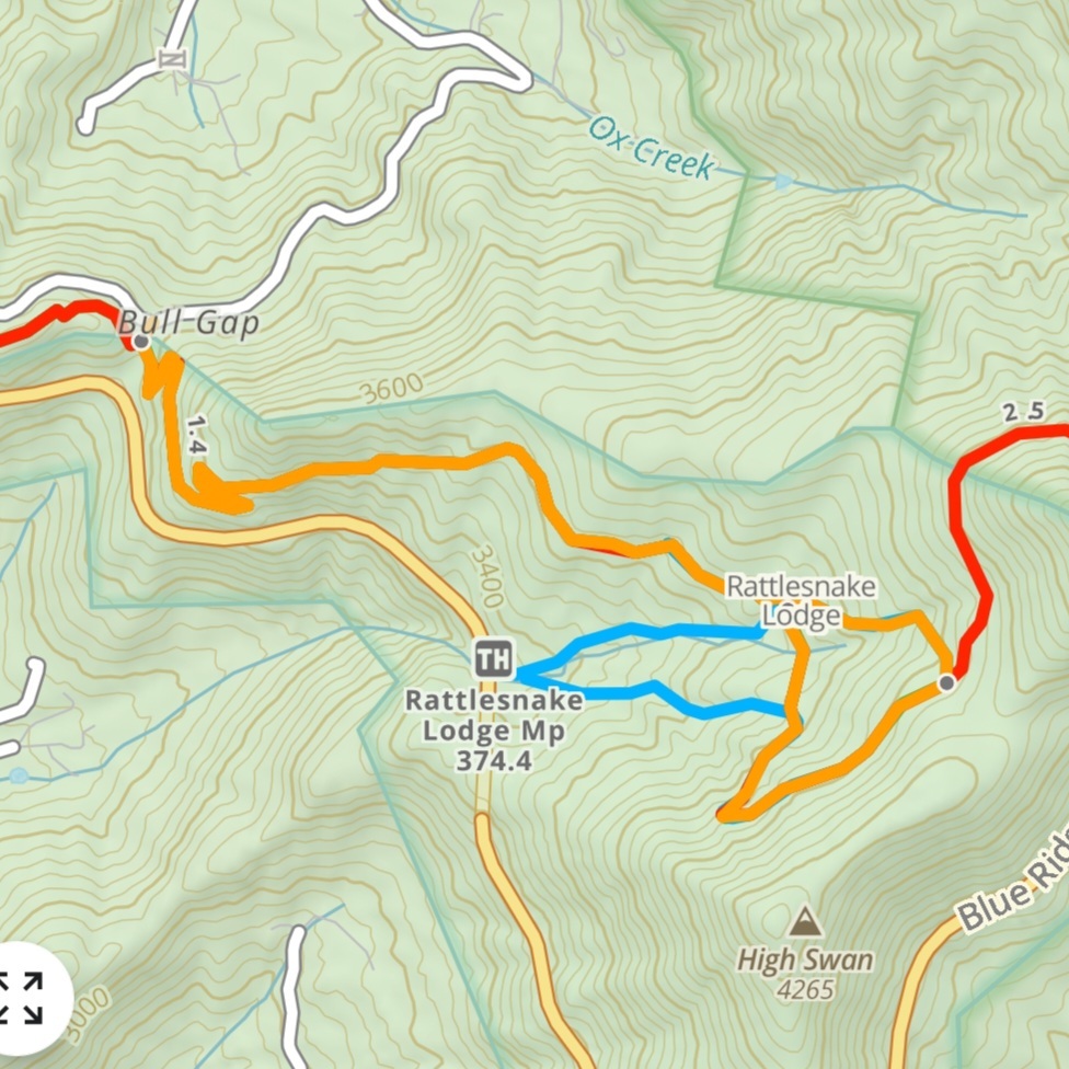 Primary Trailhead: Rattlesnake Lodge Trailhead on Ox Creek Rd
Rattlesnake Lodge was once the home of Dr Chase Ambler, one of the founding members of Carolina Mountain Club. On this 4-mile lollipop hike, you’ll see the remnants of the foundation of his home, as well as the well house, reservoir, and several other outbuildings. Starting from the Mountains to Sea Trail (MST) trailhead on Ox Creek Road, walk a short distance from the parking area to join the MST, and hike northbound. After about 1.5 miles, you’ll arrive at the site of Rattlesnake Lodge. Continue on the MST to hike past several additional outbuildings, then eventually the springhouse where you’ll see a blue-blazed connector trail on your left. This trail takes you past the reservoir and back to the MST. Return to the trailhead via the MST southbound. The parking area is small, so hikers may need to hike at other pull-offs along Ox Creek Rd or Elk Mountain Scenic Highway and use the MST to lengthen their hike. Keep in mind that if you’re parking on road-side pull-offs, make sure all 4 tires are off the pavement! This is a great close-to-town option for when the weather is rainy or when the Blue Ridge Parkway is closed.
We offer this as a guided hike! It's a great Half Day, especially in the winter when the Parkway is closed. We can also offer this as a backpacking trip for groups with kids, or who want a shorter hike to learn backpacking skills.
Graveyard Fields
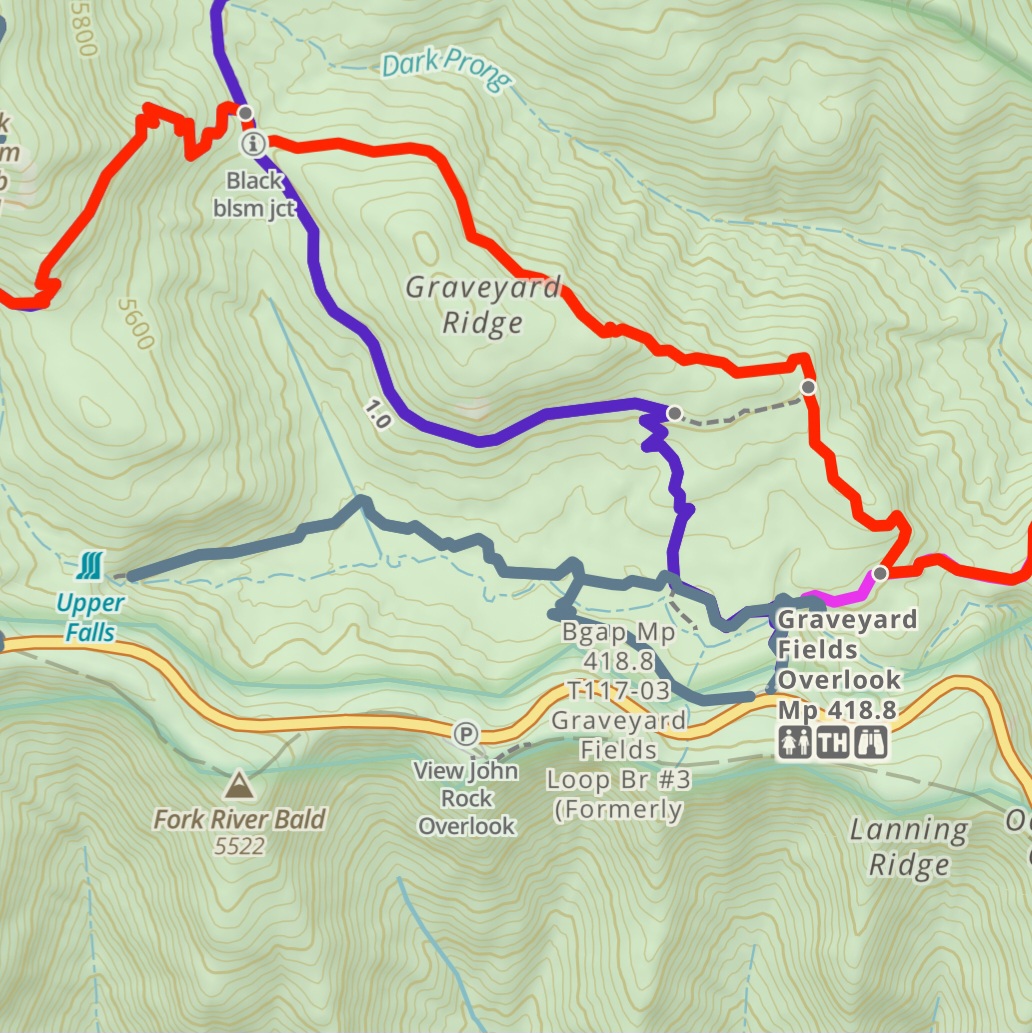 Primary Trailhead: Graveyard Fields Overlook on the Blue Ridge Parkway
It’s near peak leaf color at Graveyard Fields! Graveyard Fields is a cold sink; cold air settles into the valley and it often stays cooler than surrounding peaks. This causes its leaves to turn earlier than surrounding peaks as well, making it one of the first areas in our mountains to see color change! It’s also home to an incredibly unique variety of plant life. The hike is short (ranging from 0.5 mi to 3 mi) and relatively flat, but it is often quite muddy. Starting from the eastern end of the parking lot, hike down the stairs and cross Yellowstone Prong. At the trail intersection, going straight/right will take you down to Lower Falls (a short out-and-back). Turning left will take you around the well-marked Graveyard fields loop. At the far end of the loop, keeping left will return you to your vehicle. More adventurous hikers may choose to turn right and hike out to Upper Falls. The hike to Upper Falls is a bit more challenging than the rest of the loop, and has many unmarked social trails so it's easy to get turned around.