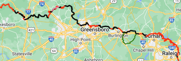
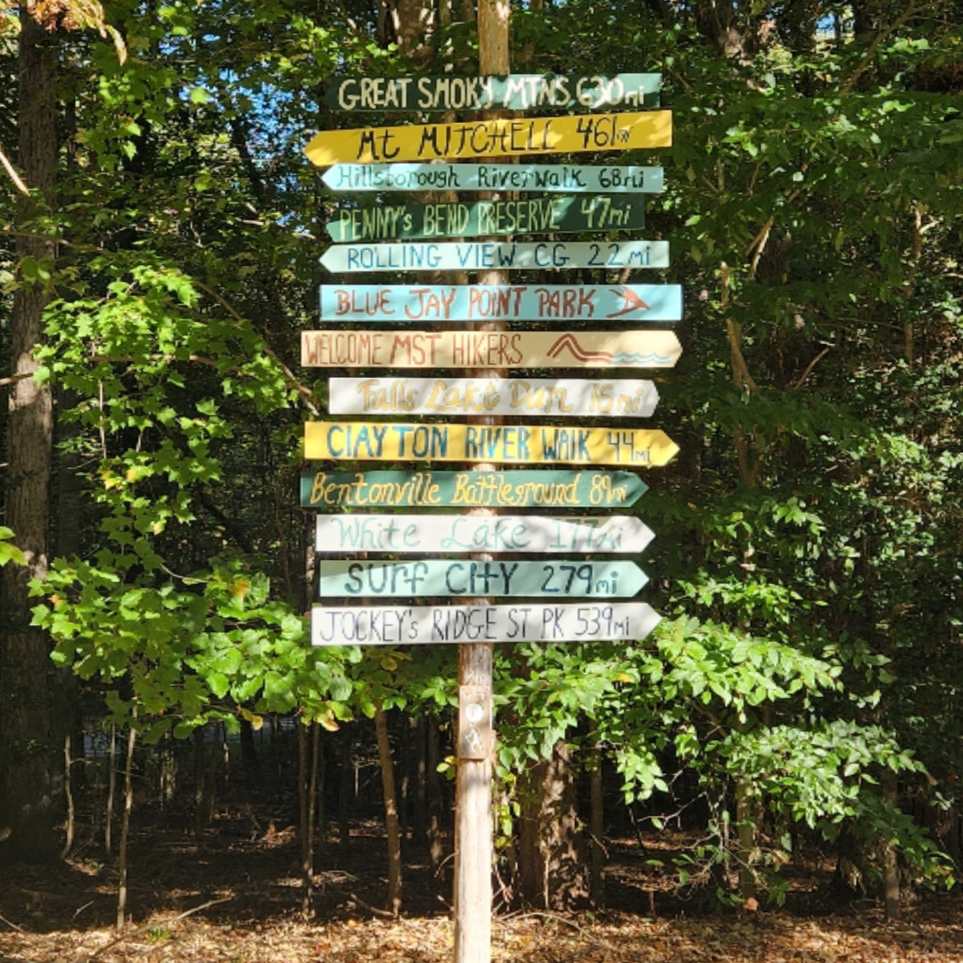
 The Piedmont section includes Segments 6-10, from Devils Garden Overlook to Falls Lake Dam (308 miles). From Devils Garden Overlook, the trail drops into Stone Mountain State Park, then travels east above Winston-Salem, Greensboro, and Burlington to Durham. From Durham, it follows the Eno River State Park and the southern bank of Falls Lake before ending at Falls Lake Dam on the northeast side of Raleigh.
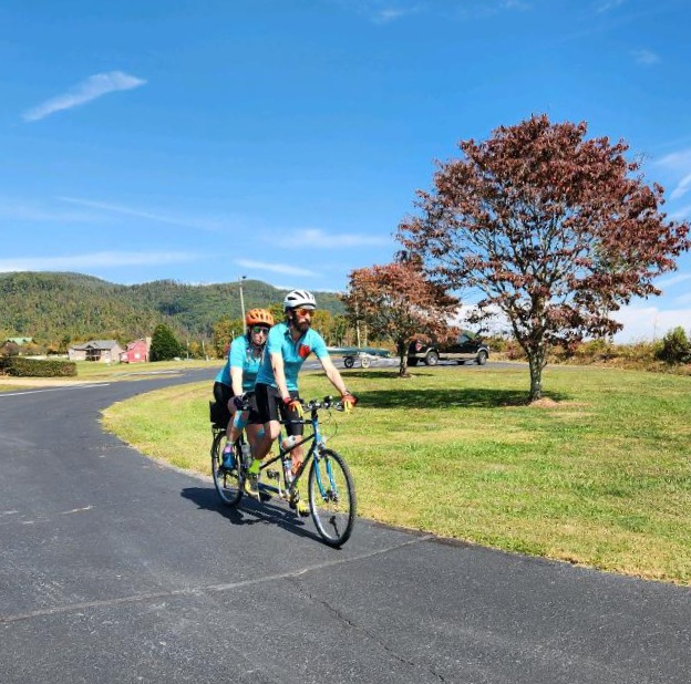
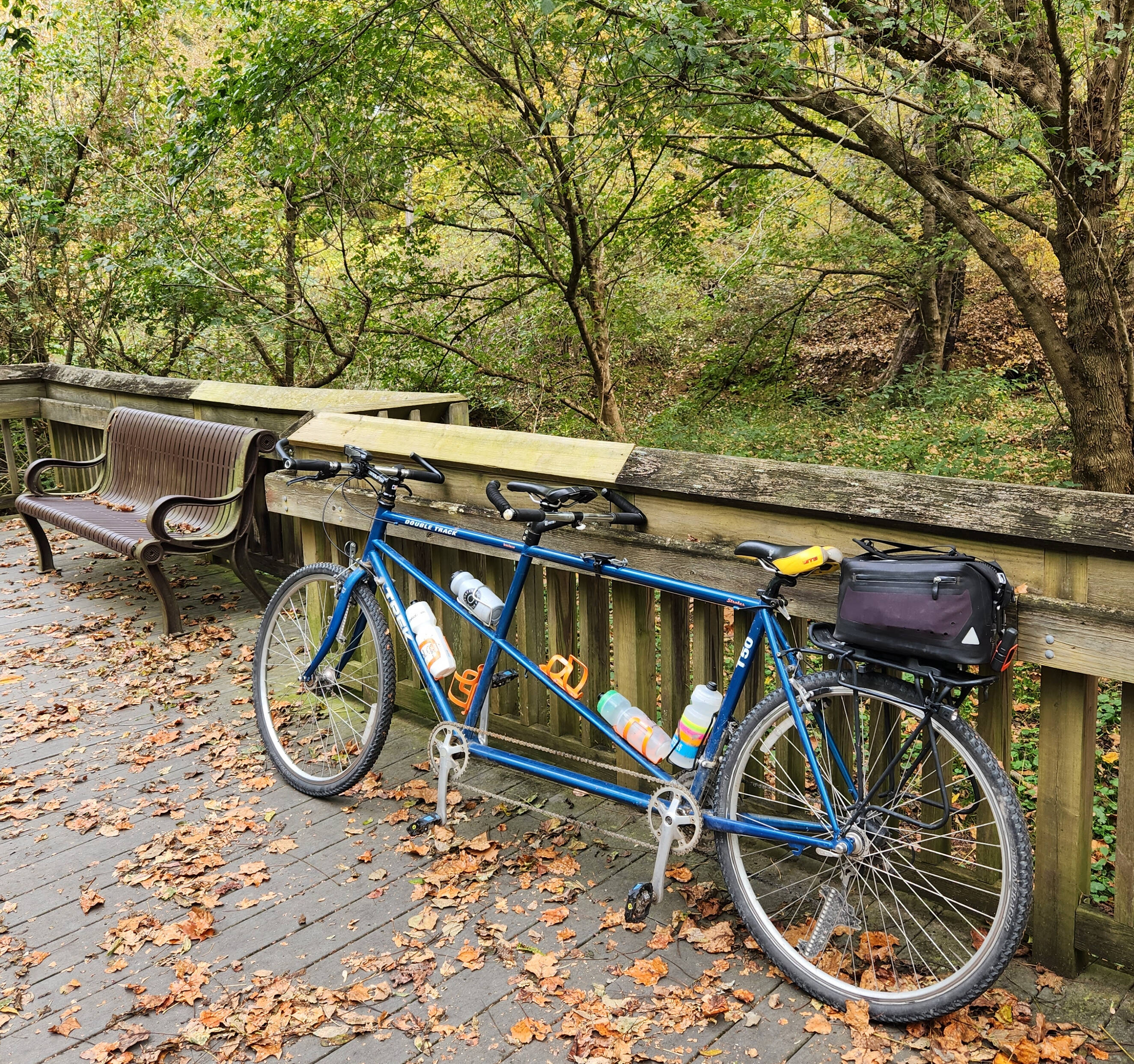
This section was a little bit more road than trail, so we were able to plan on biking a pretty large chunk. It made the miles go by really quickly! We expected this to take us a little under 2 weeks, allowing for 1 zero day and several days of slackpacking along the way. Looking back, this was much more mentally and emotionally challenging than we exepcted; having to change transportation types and constantly getting off trail overnight made the days long, and made it hard to find the motivation to keep going.
Segment 6: The Elkin Valley
Devils Garden Overlook to Pilot Mountain State Park, 69 miles [October 10 - 12]
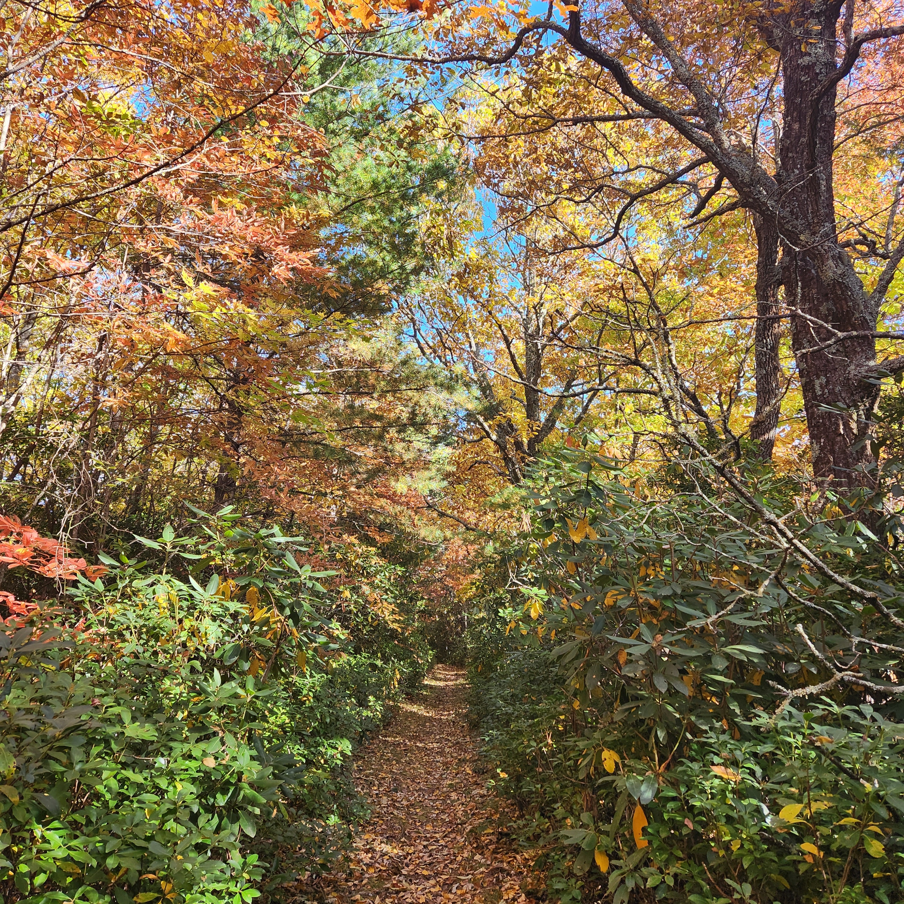 After leaving the Parkway, the trail heads into Stone Mountain State Park, then we got to hop on our bike! On the sections of trail, it is easy to tell that the Yadkin Valley Trails Association who maintains these trails care deeply about making them enjoyable to hike. They were some of the best of the trip! We rode the remainder of the segment to Pilot Mountain State Park. This area is close to where we grew up, and it really felt like heading home when we were here.
Highs: Riding our bike on some gravel roads. Meeting a group of MST trail angels at Stone Mountain State Park. Riding by Rockford General Store and stopping for a snack.
Lows: Issues with dogs running after us on the roads. Getting dumped on with cold rain on the bike.
Favorite Memory: Riding in this area felt really nostalgic. We grew up not far from Elkin and Pilot Mountain, so hiking and riding this segment felt like being home.
Segment 7: The Sauratown Mountains
Pilot Mountain State Park to Hanging Rock State Park, 37 miles [October 12 - 13]
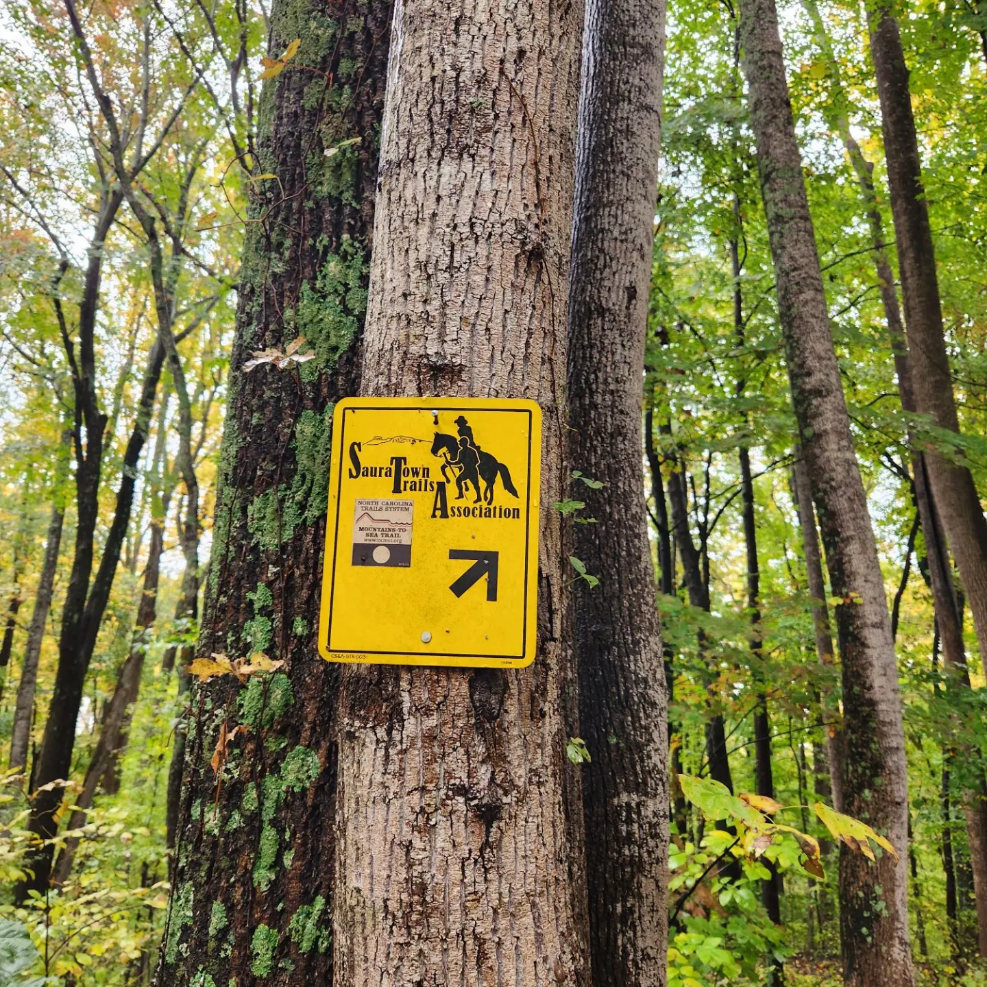 We were really looking forward to hiking the Sauratown Trail. A night of heavy rain made sleep difficult, but the rain luckily stopped mid-morning and we had pretty nice weather most of the rest of the segment. The Sauratown Trail was closed to the public for a long time, and still passes through a lot of private property. We hiked it a few years ago as part of a Make A Wish Foundation fundraiser, and it felt really great to be back.
Highs: Views of Pilot Mountain, Moore's Wall, and Sauratown Mountain.
Lows: A couple of dangerous road walks (narrow shoulders and winding roads). Pilot Mountain suffered from a large wildfire last year, and it was heartbreaking to walk through such a recent and extensive fire scar.
Favorite Memory: This segment was quite a bit more challenging than we expected and remembered, and it felt great to hike a challenging trail and not have knee pain. Plus, the campsites were some of the nicest we'd stayed in so far!
Segment 8: Rivers, Railroads, & Lakes
Hanging Rock State Park to Bryan Park, 65 miles [October 14 - 15]
We had a little bit of confusion with the meetup location to get our bike at the beginning of this segment, so we ended up hiking a couple extra miles at the start. We rode from Hanging Rock to Burr Mill, then hiked to Bryan Park.
Highs: Riding through more familiar areas. Comfortable hiking on easy, rolling trail and beautiful leaf color.
Lows: Cycling on very busy roads - much busier than we're used to or expected. Very few places to stop to take a break or have a snack on the bike, so we completely crashed at the end of the day.
Favorite Memory: Because we were so close to home, we got a lot of help and support from our families!
Segment 9: Revolution & Textiles
Bryan Park to Eno River State Park, 60 miles [October 16]
 This was one of the places we got a little bit creative. The "official" route this segment goes on and off trail a lot with a lot of short trail sections amid long-ish stretches of road. We made the decision to just ride the whole way and have a cruiser day on the bike, which removed a lot of stress from the day.
Highs: We got a pretty early start, and avoided a lot of the weekend traffic on the roads.
Lows: The MST routed us down Highway 70 which was absolutely not a safe road to have hikers or cyclists on. This HAS to be rerouted to keep hikers safe!
Favorite Memory: Stopping in Mebane to get ice cream sundaes in the middle of the afternoon.
Segment 10: Eno River & Falls Lake
Eno River State Park to Falls Lake Dam, 79 miles [October 17 - 21]
This is the longest stretch of trail we'd been on since leaving Stone Mountain State Park, and it was a welcome change! These 80 miles of trail are beautiful, and would make a great section hike once Rolling View Campground reopens.
Highs: This was the first time in a while that it felt like we were actually backpacking. Got to see some great live music one night coming through Raleigh. We saw the first evidence of other WB thru-hikers in a trail log - a couple who were about a week ahead of us!
Lows: A very scary storm overnight one night with lightning and high winds and hail. Knee pain started coming back toward the end of this segment.
Favorite Memory: Midway through this segment, a friend picked us up to stay a night in Raleigh and see two of our favorite bands!