The North Carolina Mountains-to-Sea Trail runs 1,175 miles from Clingmans Dome on the NC/TN Border to Jockey's Ridge on NC's Outer Banks. It is divided into 3 sections (Mountains, Piedmont, Coast) and 18 Segments. Because the MST covers so many miles on backroads, completers are allowed to bike the road portions. Additionally, there are two optional paddle segments - the Yadkin River from Elkin to Pilot Mountain and the Neuse River from Smithfield to Cherry Branch beach. My hiking partner and I are avid cyclists and canoeists, so we opted for the multi-sport approach and planned to complete the Neuse River paddle section and bike most of the remaining road sections.
One of the biggest challenges with completing the MST is inconsistent campsite and resupply availability. There are some areas of trail where campsites are plentiful, and other long stretches with limited or no camping. While I'm sure this is true on many trails, it feels much more acute on the MST, with several areas with multiple days of hiking without camping options. It means that hikers are forced to hike very long days (sometimes heading several miles off trail to camp), rely on Trail Angels for lodging, and/or choose to camp illegally. In most areas, resupply options are not located on trail and hikers need to get a ride into town to resupply. Only 20-30 hikers complete he MST per year, so many communities along the trail don't have a lot of hiker-friendly lodging (several times we found ourselves in small town where the only hotels had a 2 night minimum), and may not have trail-friendly food options. Additionally, I have several dietary restrictions that make resupply difficult. Because of all this, I spent a LOT of time before we left planning out every aspect of our trip - mapping out camping/lodging locations, planning and packing our resupply packages, when and where we'd swap gear, etc.
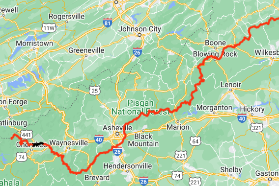 The Mountains section includes Segments 1-5, from Clingmans Dome to Devils Garden Overlook (about 350 miles). Generally, the trail moves from Clingmans Dome through the Smokies to Cherokee, then follows the Blue Ridge Parkway to Mt Mitchell. From there, it travels through Linville Gorge, before re-joining the Parkway near Grandfather Mountain. From there, it again follows the Parkway northeast to Devils Garden Overlook. This section is primarily trail, with short sections of walking on either the Parkway or gravel roads. We chose to hike the whole way.
We expected this to take us a little over 3 weeks, including 2 zero days (days where we hike no miles) and one day of slackpacking (hiking with just a day pack instead of a full backpack). We had some bonus zero days thrown in while I dealt with an injury and we had to get off trail for a hurricane. This section brought the most physical challenges, which wasn't too surprising, since it had the most technically difficult sections of trail. And looking back on our trip, it is what felt the most like a "thru-hike".
Segment 1: Peak to Peak
Clingmans Dome to Waterrock Knob, 49 miles [September 15 - 18]
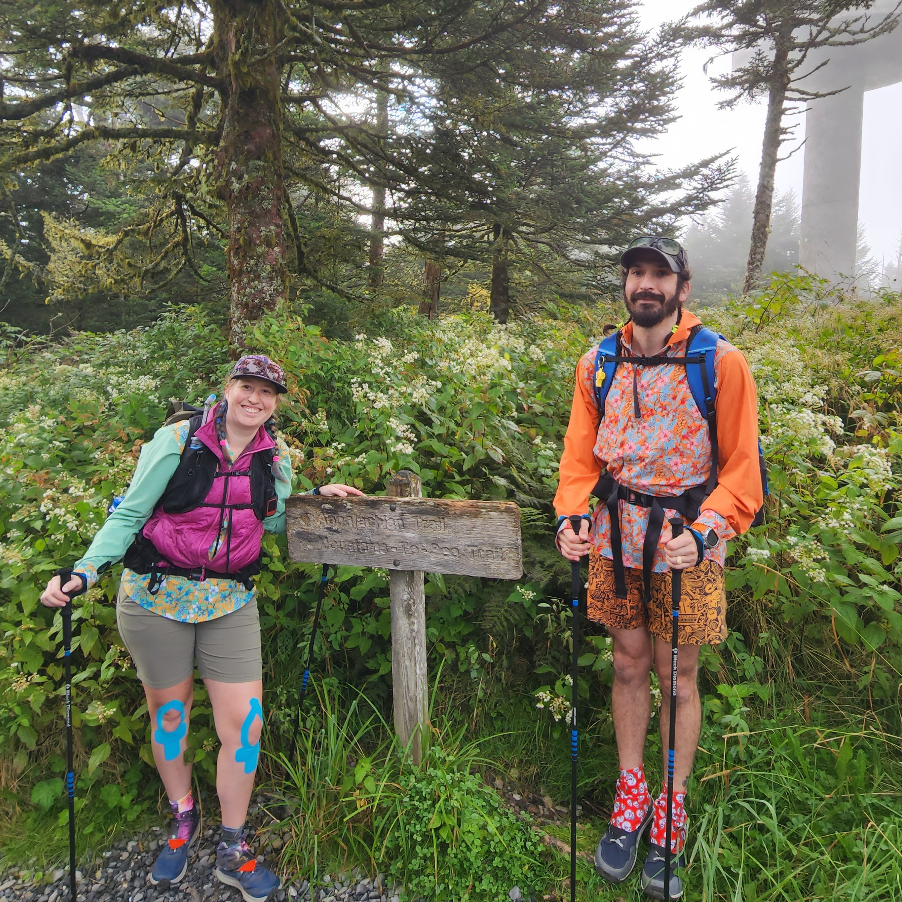
This was one of the Segments I was most looking forward to hiking, as I absolutely love the area of the Smokies that the trail passes through. The forest was mostly lush greens, filled with ferns and mosses and late season wildflowers. We realized in this segment that we were doing more road walking than we anticipated, because the MST Guide lists gravel road and some short stretches of the Parkway as "trail" sections.
Highs: Hiking through a section of the Smokies that doesn't see a lot of foot traffic. Dipping our toes in the Oconoluftee River as we finished hiking in the Smokies. Looking west from Mile High Campground and being able to see Clingmans Dome in the distance.
Lows: A VERY buggy campsite in the Smokies. More road walking than we anticipated, which I find to be very physically draining (even though the miles pass quickly). I developed pain in my left achilles.
Favorite Memory: Being able to see Clingmans Dome in the distance from Mile High Campground.
Segment 2: The Balsams
Waterrock Knob to Pisgah Inn, 63 miles [September 18 - 22]
 This section had some of the most remote hiking on the trip! We saw very few people hiking through the "forgotten fourteen" in Nantahala National Forest, Middle Prong Wilderness, and the Balsams. Campsites were a little bit more plentiful, but many did not have water, resulting in some long water carries.
Highs: Hiking through Nantahala National Forest and one of our favorite campsites of the trip. Early fall colors in Graveyard Fields. Soaking my feet in the water at Skinny Dip Falls. Great trail magic from friends and strangers.
Lows: A couple of long water carries. HOT weather. Swelling and pain from several yellow jacket stings. Road and railroad walking made my knee and achilles injuries flare up.
Favorite Memory: The BEST trail magic! A close friend drove out from Asheville to bring me a new pair of shoes to help with my achilles pain, and showed up with fresh guac, wine, and cold cheerwine. After walking 2 miles off trail down a railroad track on an 80+ degree day to get to a campground, someone at the campground treated us to ice cream and helped coordinate a ride back to the trail the next day. A friend surprised us with an epic trailside waffle breakfast at one of the road crossings.
Segment 3: The High Peaks and Asheville
Pisgah Inn to Black Mountain Campground, 71 miles [September 23 - 27]
 Being from Asheville, we were already pretty familiar with this Segment. Still, we were surprised by how beautiful and challenging a couple areas were. We enjoyed a zero at home in Asheville, and a friend slackpacked the next day. I developed severe pain in my left knee hiking through the Craggies, bad enough that I was in tears with every step and I ended up getting off trail near Mt Mitchell to seek medical care. No obvious broken bones or tears, my doctor suspected a stress fracture or pinched nerve and administered a nerve block to get me back on trail within a few days.
Highs: Our first below freezing night at Pisgah Campground and starting our hike early enough to watch sunrise at Buck Springs Lodge. Switching shoes helped my achilles pain so much! An unexpectedly challenging and beautiful section of trail near Lane Pinnacle.
Lows: Emotionally struggling with feeling like I'd been in almost constant pain the first 2 weeks of the trip. Dealing with a knee injury. Having to get off trail and separate from my hiking partner.
Favorite Memory: A friend hooked us up with a sweet cabin to stay in one very cold night in a stretch of trail with incredibly limited camping.
Segment 4: Gorges, Peaks, and Waterfalls
Black Mountain Campground to Beacon Heights, 75 miles [September 28 - October 5]
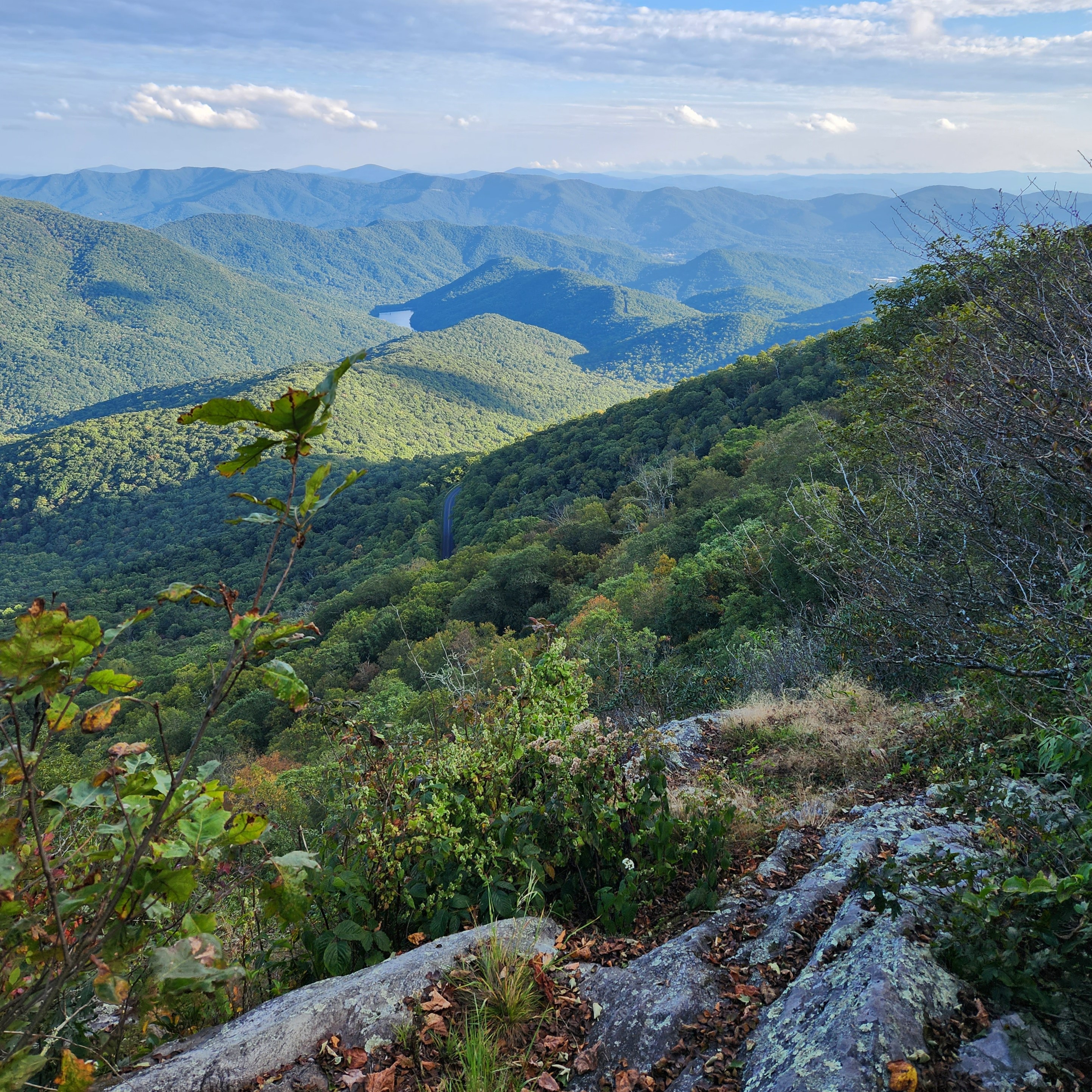
 This Segment goes through Linville Gorge and Wilson Creek wilderness areas - a beautiful but rugged and poorly marked region with many water crossings. Just a day into Segment 4, we got off trail for a few days to wait out a hurricane. The first day back after the hurricane, I had to get off again because of knee pain to go to an Orthopedic Urgent Care. A second doctor suspected pain from an ongoing alignment issue and/or a torn meniscus, and administered a cortisone injection. He was not optimistic that I would be able to finish the trail, given the pain I had experienced so far.
Highs: Hiking through Linville Gorge
Lows: Cold, windy weather at Table Rock while my partner and I waited for someone to pick me up. Dealing with the idea that the trip may be over for me, and making plans for my partner to still be able to finish.
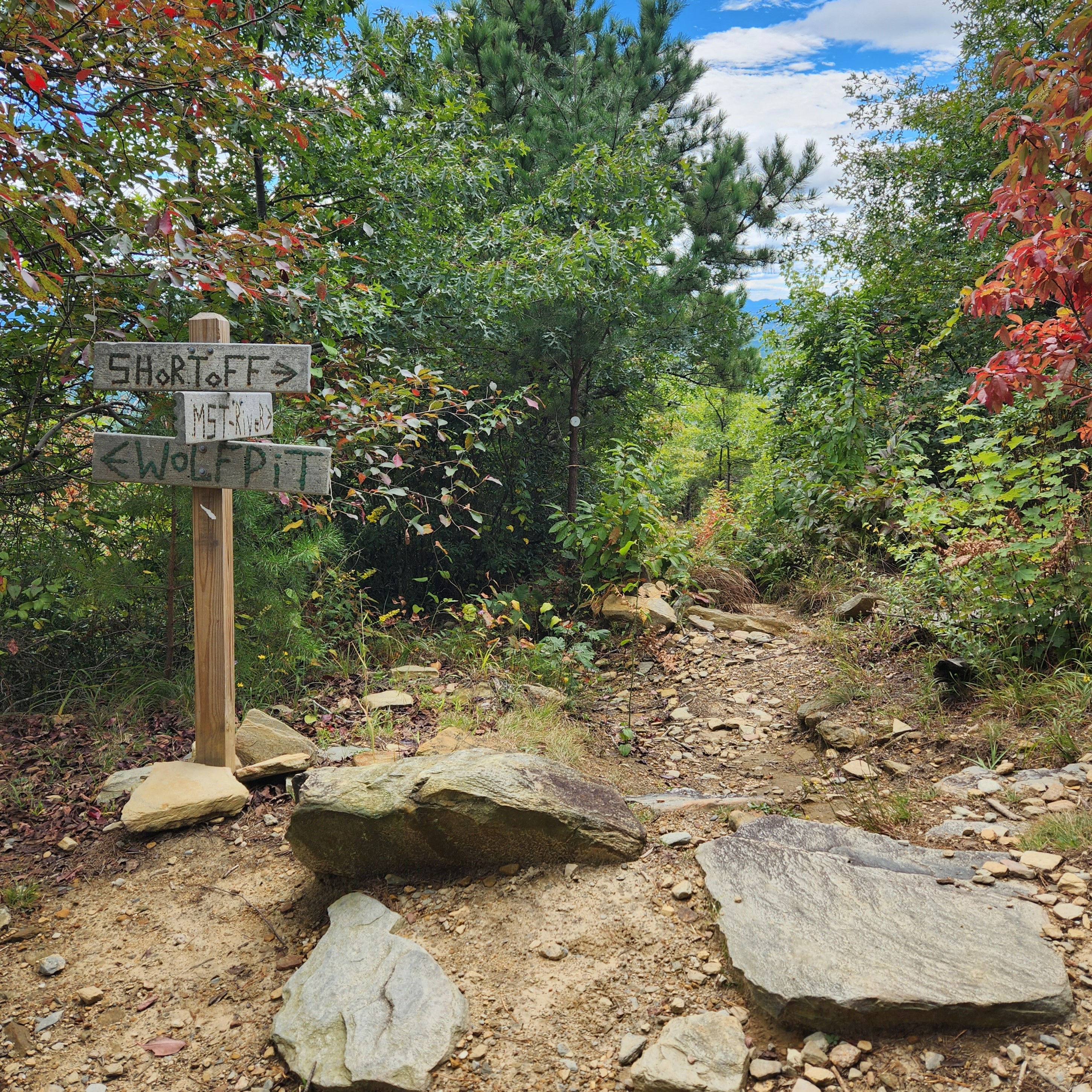
Favorite Memory: The view from Shortoff Mountain
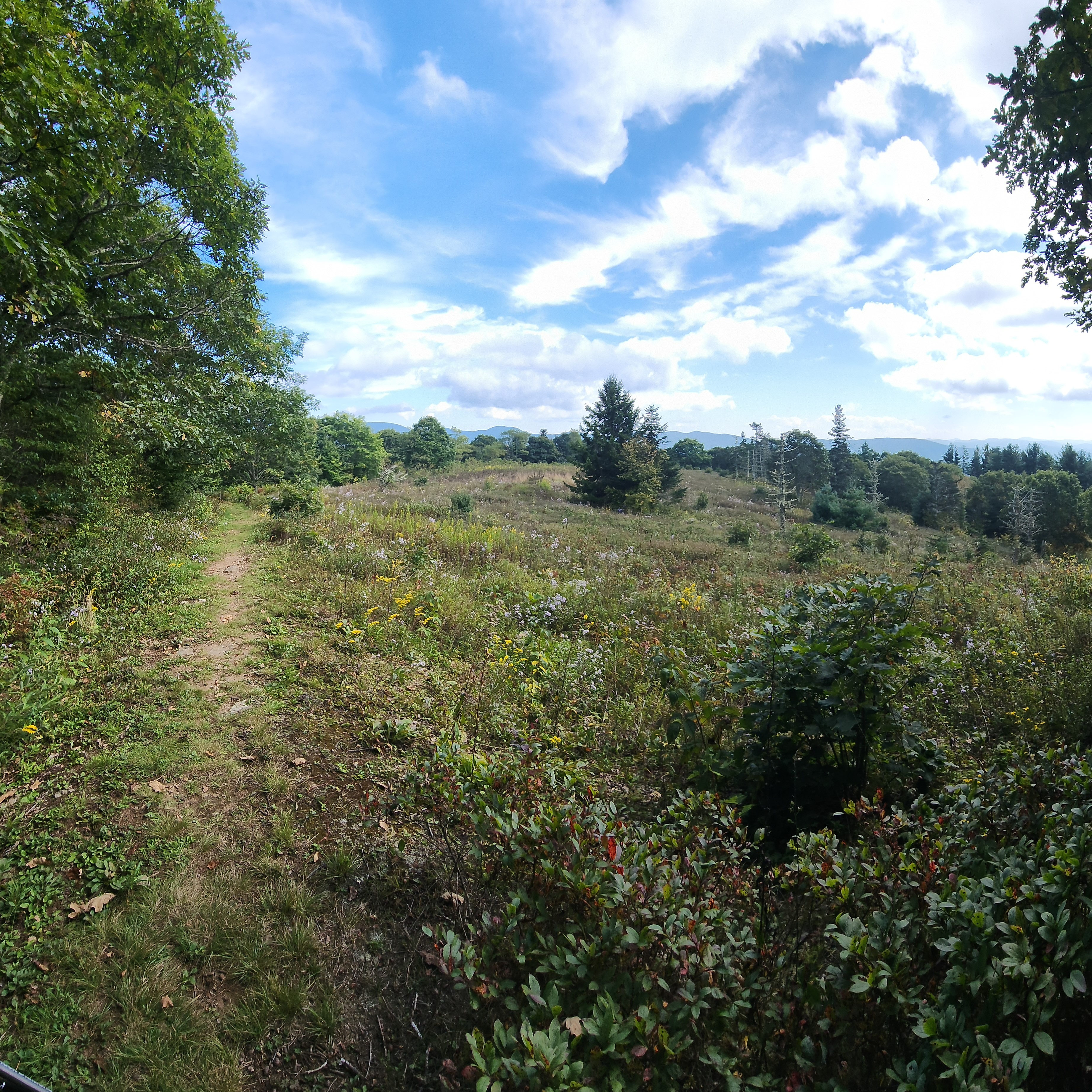
Segment 5: The High Country (91 miles)
Beacon Heights to Devils Garden Overlook, 91 miles [October 5 - 10]
 I joined my hiking partner at Julian Price Park (around 13 miles into the Segment), with the plan to take it day by day and see how my knee responds. We arranged for a friend to slackpack us the first day and made plans for where I could get off trail over the following few days if needed. This section of the Parkway had several small campsites open to long-distance hikers, which is something I think should/could be implemented along the entire MST Parkway corridor. Again, there was more road walking than we expected, with the Parkway segments being labelled as "trail" in the guide book.
Highs: Finally having a few days with minimal pain. Seeing turkeys fly between treetops at camp one night. Peak fall color. Getting the first view of the mountains dropping off to the piedmont, and seeing my hometown in the distance.
Lows: Campsites had a group size limit of 12, but were barely large enough for 1-2 tents. A few rough nights of sleep. An unexpectedly aggressive cow in one of the pastures we had to walk through.
Favorite Memory: My sister-in-law picked us up from trail one night and treated us to a DELICIOUS home cooked meal and a night in a warm, comfy bed. A close second was having several days of hiking without pain, and feeling so relieved that I was able to keep hiking!